
Risk Maps & Climate Change Projections
Explore advanced climate change projections maps designed for accurate regional climate analysis and climate change adaptation planning. Identify asset exposure, analyse vulnerability, and define adaptation.
Enhance your Climate Geospatial Analysis. Physical Climate Risk Mapping Solution
Data Sources
ERA5 and Vortex data for past and present climate data, alongside downscaled Global Climate Models (GCMs) for future projections and various socio-economic and environmental layers of information. These datasets enable crossing the relevant layers necessary to inform decission making processes towards climate resilience.
Climate Scale offers consistent, user friendly, comprehensive climate risk maps development across any region of your interest.
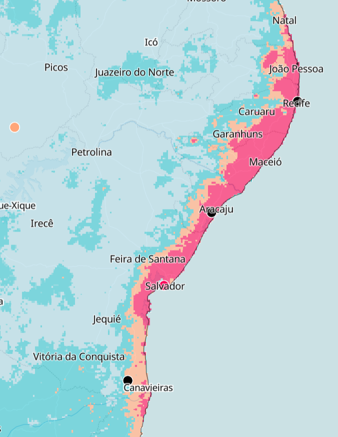
Climate Risk Mapping
Using high‑resolution climate risk maps allows identifying where physical climate hazards intersect with critical infrastructure, communities, and natural systems.
By overlaying past and future hazard intensity with socio‑economic, environmental, and asset data, the platform helps quantify exposure, prioritize hotspots, and design targeted adaptation measures grounded in rigorous climate risk maps and vulnerability analysis.
Wether you have linear assets, data points or broad regions to explore, Climate Scale privides the tool necessary to quantify exposure and vulnerability to any climate change risk your porfolio might face in the future.
+20 Climate Models
Data from more than 20 selected downscaled Global Climate Models (GCMs), utilized in the creation of detailed climate change projections maps.
This ensemble approach strengthens the accuracy of your regional climate analysis and improves the reliability of future impact assessments.
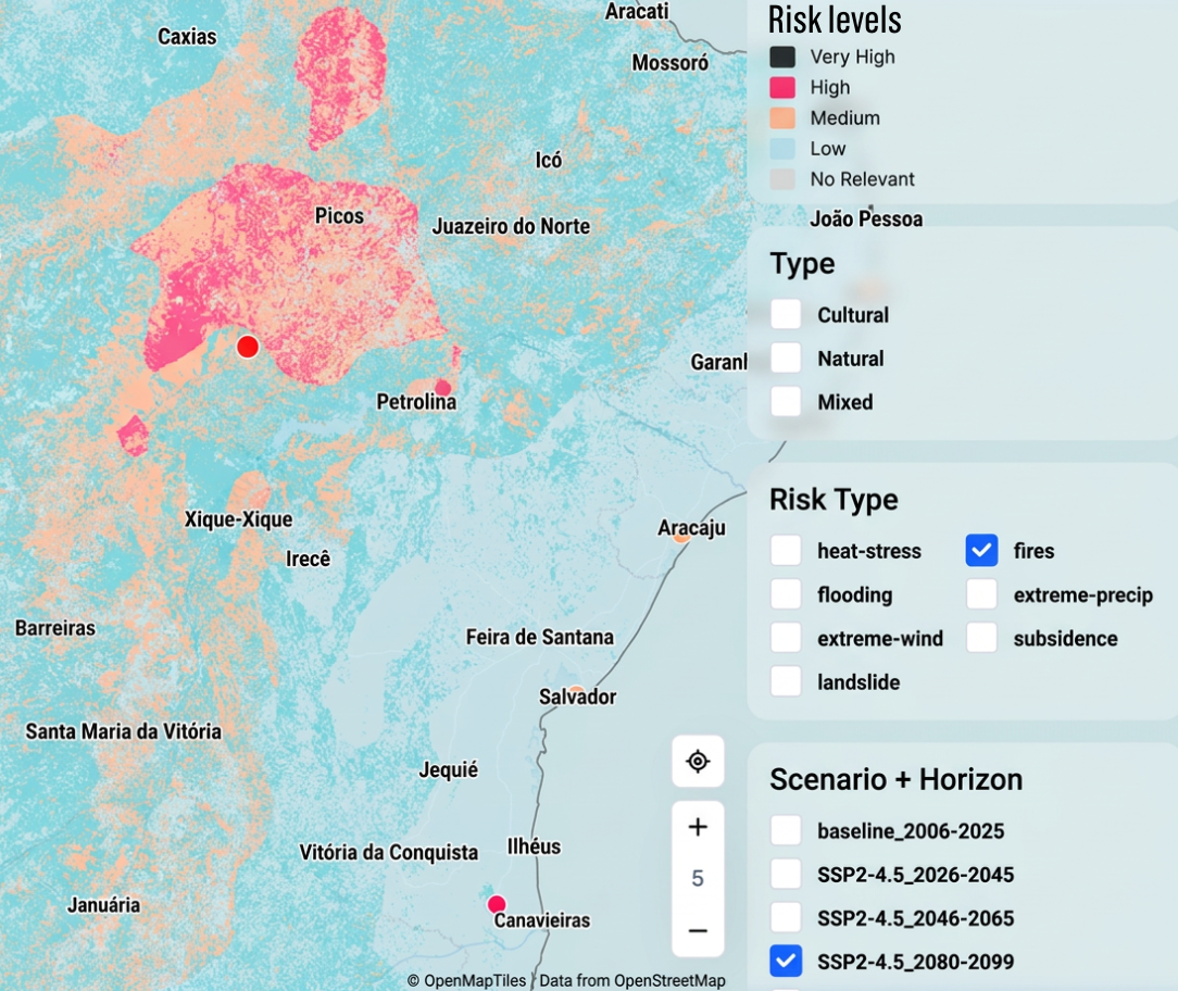
Future Projections
Projections are available for short-term (2020-2039), medium-term (2040-2059), and long-term (2080-2099) periods, including SSP emission scenario pathways and their associated uncertainties, forming the foundation for climate change projections maps. Time horizons and selection of emission scenarios are fully customisable by the user!
These datasets form the foundation for robust climate change projections maps and scenario-driven climate change adaptation planning. Along with our 20+ years of combined experience in physical risks, Climate Scale provides the full package to inform your most resilient strategy.
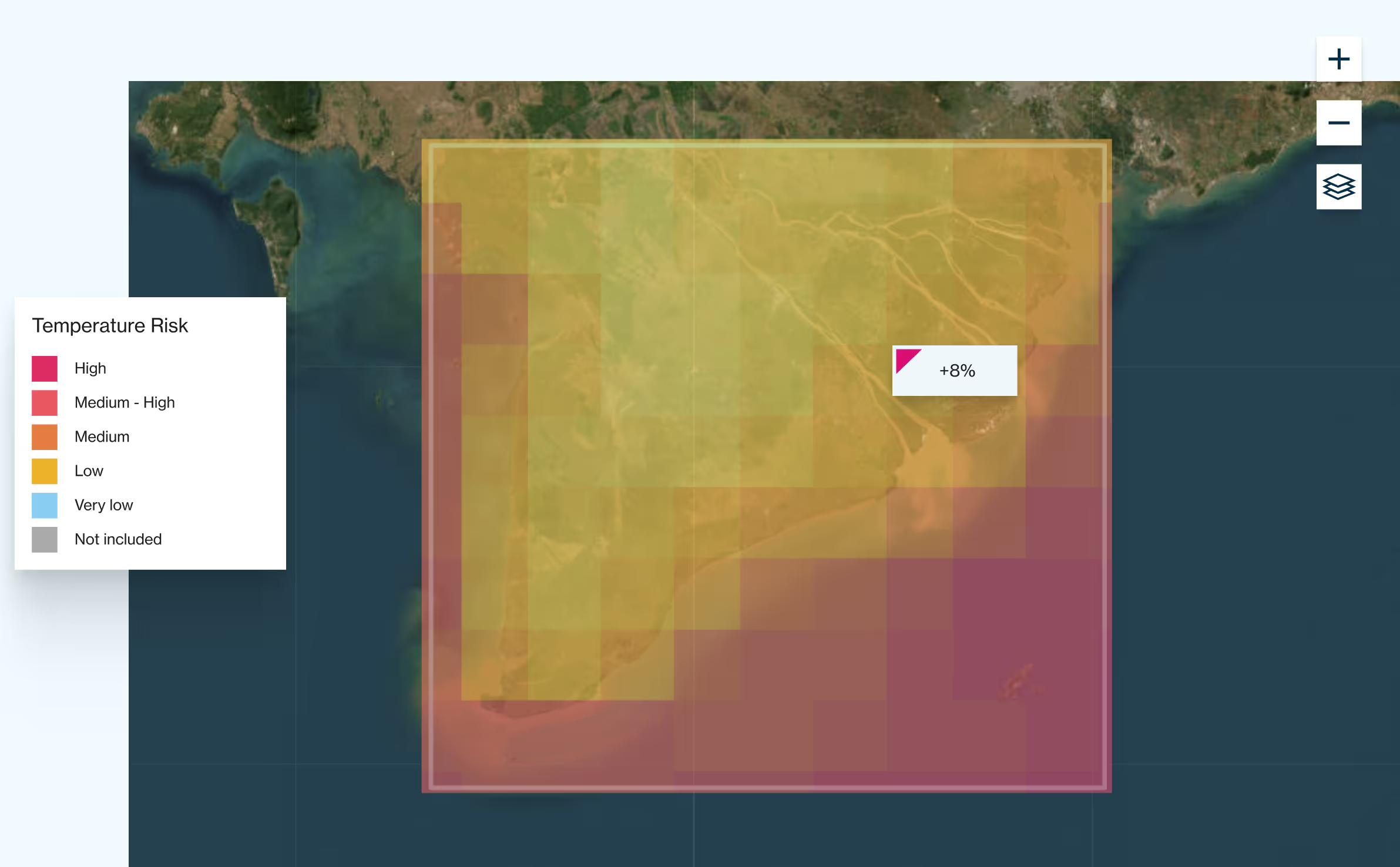
Resolution and Formats
Deliverables include climate risk maps and climate change projections at asset level anywhere in the world. Data is provided via an online interface and Atlas GIS interactive tool. The information can be visualised in the platform and downloaded in raster and KMZ/TIFF formats. Resolution ranges from a few meters to a minimum of 25 km spatial resolution depending on the metric.
The selection of relevant metrics, emission scenarios and time horizons is fully customisable at project level.
.avif)
.avif)


