
Climate Change Projections Maps
Explore advanced climate change projections maps designed for accurate regional climate analysis and climate change adaptation planning. High-resolution climate projection maps showcase projected changes across sector-specific climate variables, time horizons, and emission scenarios.
Enhance your Climate Geospatial Analysis
Data Sources
Utilise ERA5 and Vortex data for past and present climate data, alongside downscaled Global Climate Models (GCMs) forfuture projections, supporting comprehensive climate change projections maps. These datasets enableconsistent climate change mapping and comprehensive climaterisk map development across multiple regions.
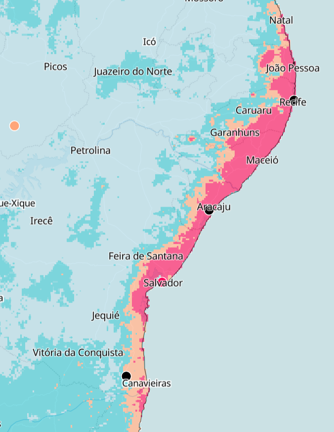
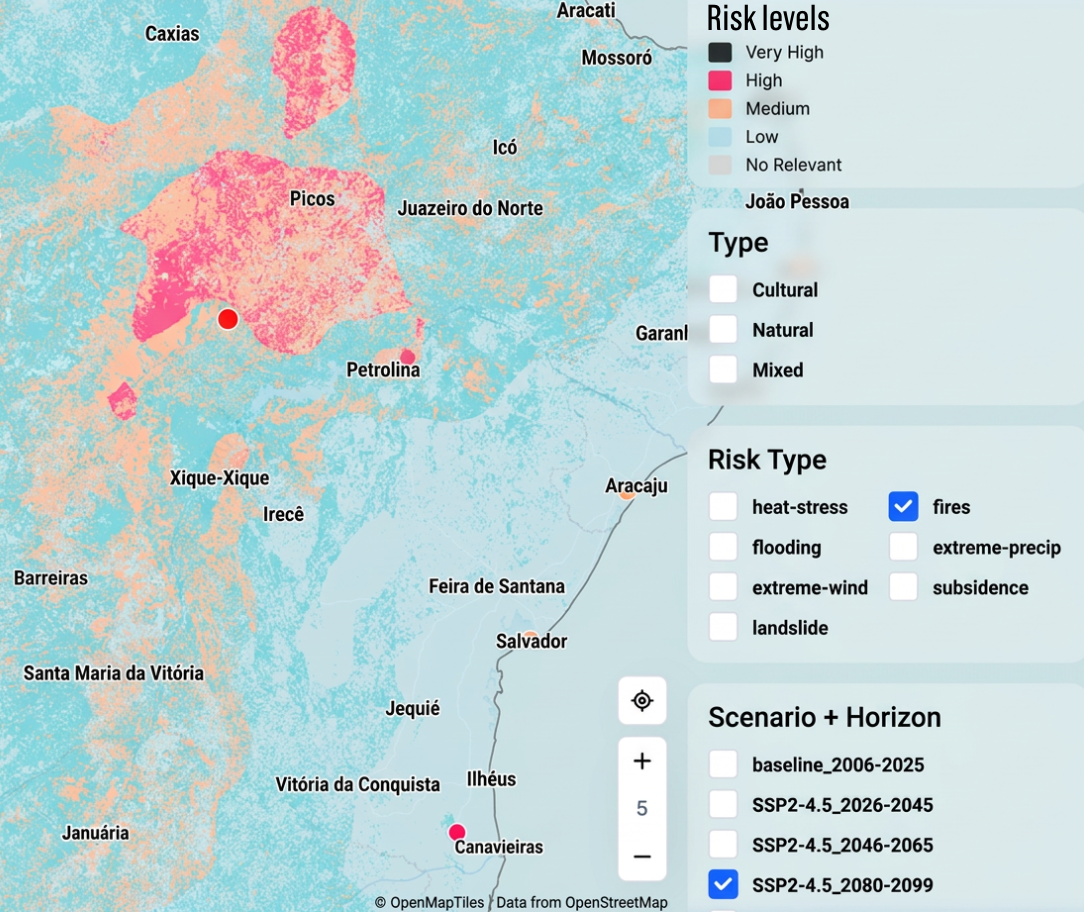
Climate Risk Mapping
Analyse climate spatial variability across multiple metricswithin the wind, solar, water, soil, and temperature categories, leveraging high-resolution climate change projections maps and regional climate analysis tools for enhanced spatial insight and climaterisk mapping.
+20 Climate Models
Data from more than 20 selected downscaled Global Climate Models (GCMs), utilized in the creation of detailed climate change projections maps.
This ensemble approach strengthens the accuracy of your regional climate analysis and improves the reliability of future impact assessments.
Future Projections
Projections are available for short-term (2020-2039), medium-term (2040-2059), and long-term (2080-2099) periods, including SSP emission scenario pathways and their associated uncertainties, forming the foundation for climate change projections maps.
These datasets form the foundation for robust climate change projections maps and scenario-driven climate change adaptation planning.
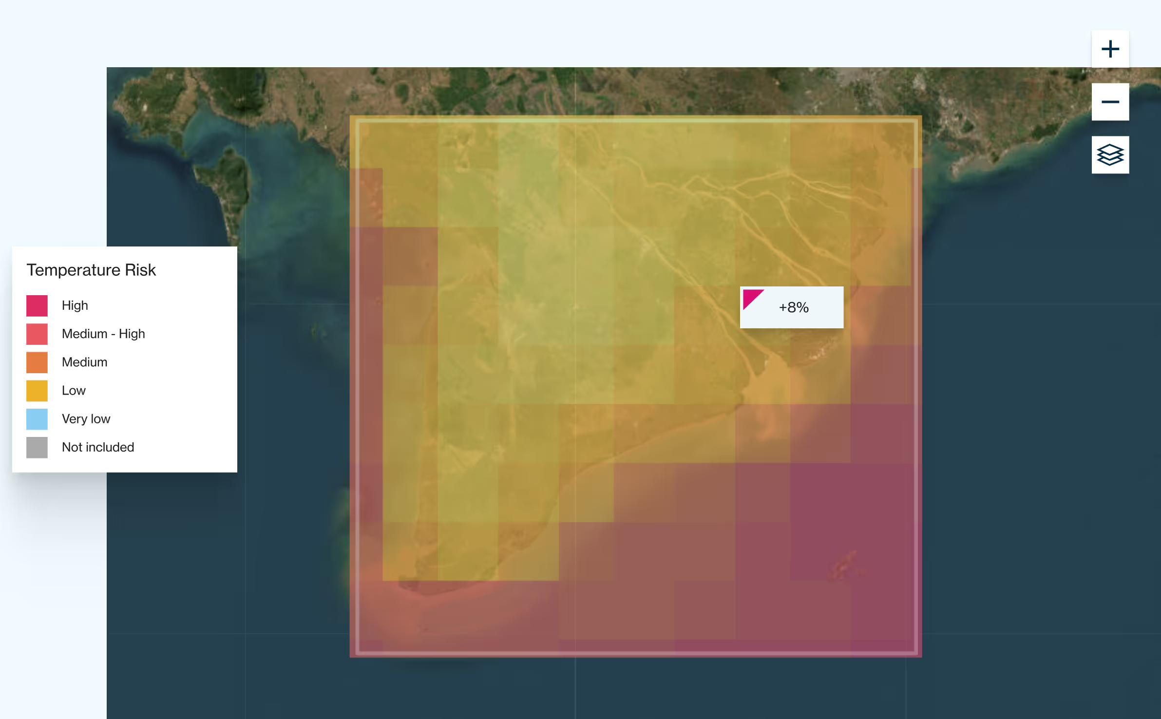
Resolution and Formats
Deliverables include climate riskmaps and climate change projections maps covering up to 100,000 km² anywhere in the world. Data is provided in raster and KMZ/TIFF formats, with a 25 km spatial resolution for general assets, ideal for large-scale regional climate analysis and climate change risk mapping.
.avif)
.avif)


